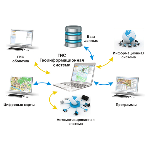
Разработка программного обеспечения в области геоинформационных технологий и компьютерного моделирования инженерных коммуникаций с использованием передовых геоинформационных технологий, пакетов расчетов инженерных сетей (теплоснабжение, водоснабжение), а также пакетов АРМ и теплотехнических расчетов.
Мы окажем весь спектр работ и услуг по разработке и внедрению геоинформационных систем и приложений на их основе, интегрируем ГИС с автоматизированными системами управления технологическими процессами заказчика.
Минимальная конфигурация: пакет ГИС, набор карт с согласованной слоевой структурой, ПТК диспетчерского управления, набор интерфейсов/оборудования глобального позиционирования и дистанционного зондирования.
Масштаб карт: по требованиям заказчика.
Потребители: ресурсодобывающие отрасли, нефте- и газоразведка, иные производственные отрасли с территориально разнесенными объектами управляемой инфраструктуры. Транспортные организации и наземные службы перевозок. Предприятия агропромышленного комплекса, землеустроительных служб, водоканала, организаций контроля соответствующих министерств и ведомств.
Направления создания ГИС:
- ГИС инженерных сетей и коммуникаций
- ГИС интеллектуального здания
- ГИС для международных логистических центров
- ГИС мониторинга инфраструктуры и ресурсов
- ГИС управления в кризисных ситуациях
- ГИС планирования развития и мониторинга сетей передачи данных
- Геоинформационная аналитическая система управления природопользованием и охраной окружающей среды
- ГИС экологического мониторинга и управления
- ГИС “чистый город”
- ГИС точного земледелия
- другое по требованиям заказчика.
Контактные данные:
Физико-технический факультет
Кафедра информационных систем и технологий
г. Гродно, ул. Поповича, 50
+375 (152) 68 24 06 - Бейтюк Юрий Ростиславович


